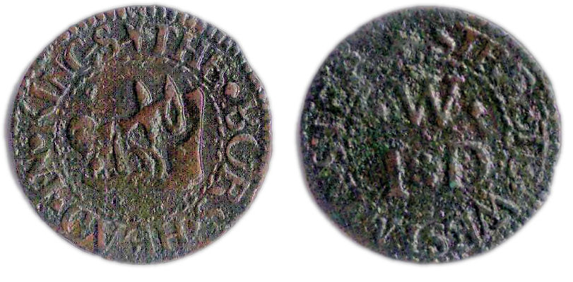
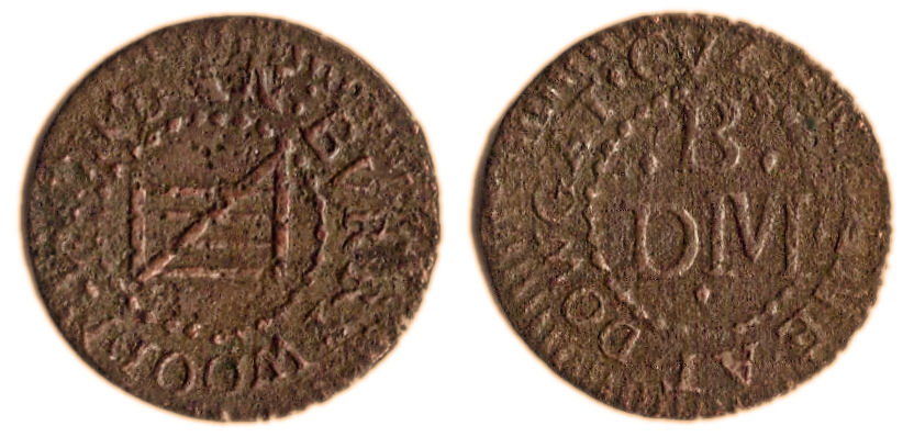
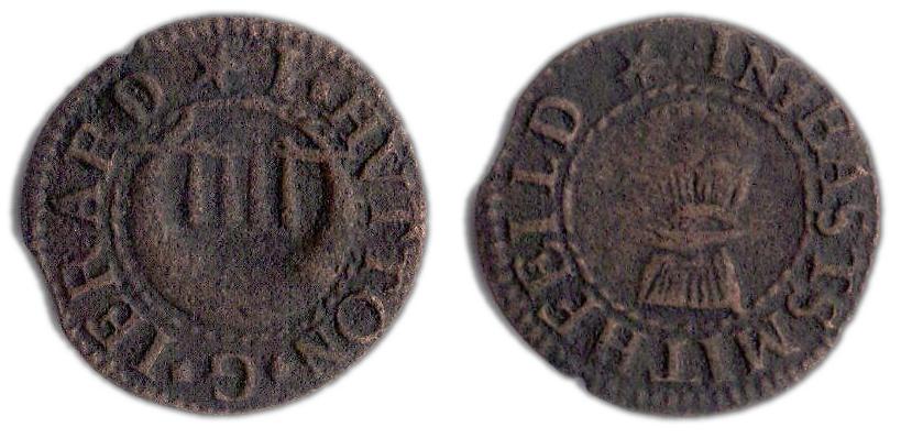
A farthing token issued in the names of Daniel Burry of Cousin Lane, London
The above copper farthing token measures 15.9 mm and weighs 0.76 grams. It was issued in the name of Daniel Burry of Cousin Lane, Dowgate. Cousin Lane was located in the Dowgate Ward of the city and ran off the south side of Thames Street down to a slip way and wharf on the River Thames. This lane formed the western boundary of Steelyard (or Steel / Still Yard) and was located in an area containing several warehouses and goods storage yards all of which backed onto the north bank of the River Thames.
The design of the token may be formally described as follows;
Obverse: .DAN . BURRY WOODMVNGR , around twisted wire inner circle, depiction of four barred gate within.
Reverse: .CVZEN LANE . AT . DOWGAT, around twisted wire inner circle, a triad within reads D|.B.|M below (.)
On stylistic grounds this farthing token appears to date from the mid 1650s t0 the early 1660s.

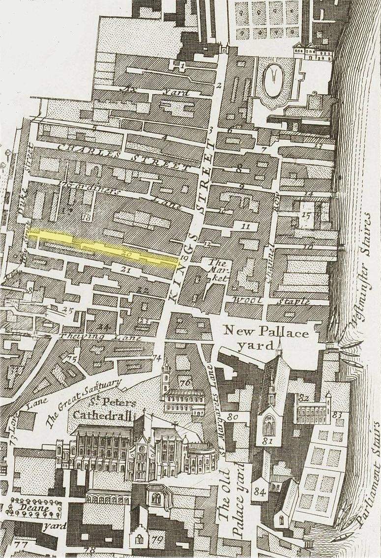
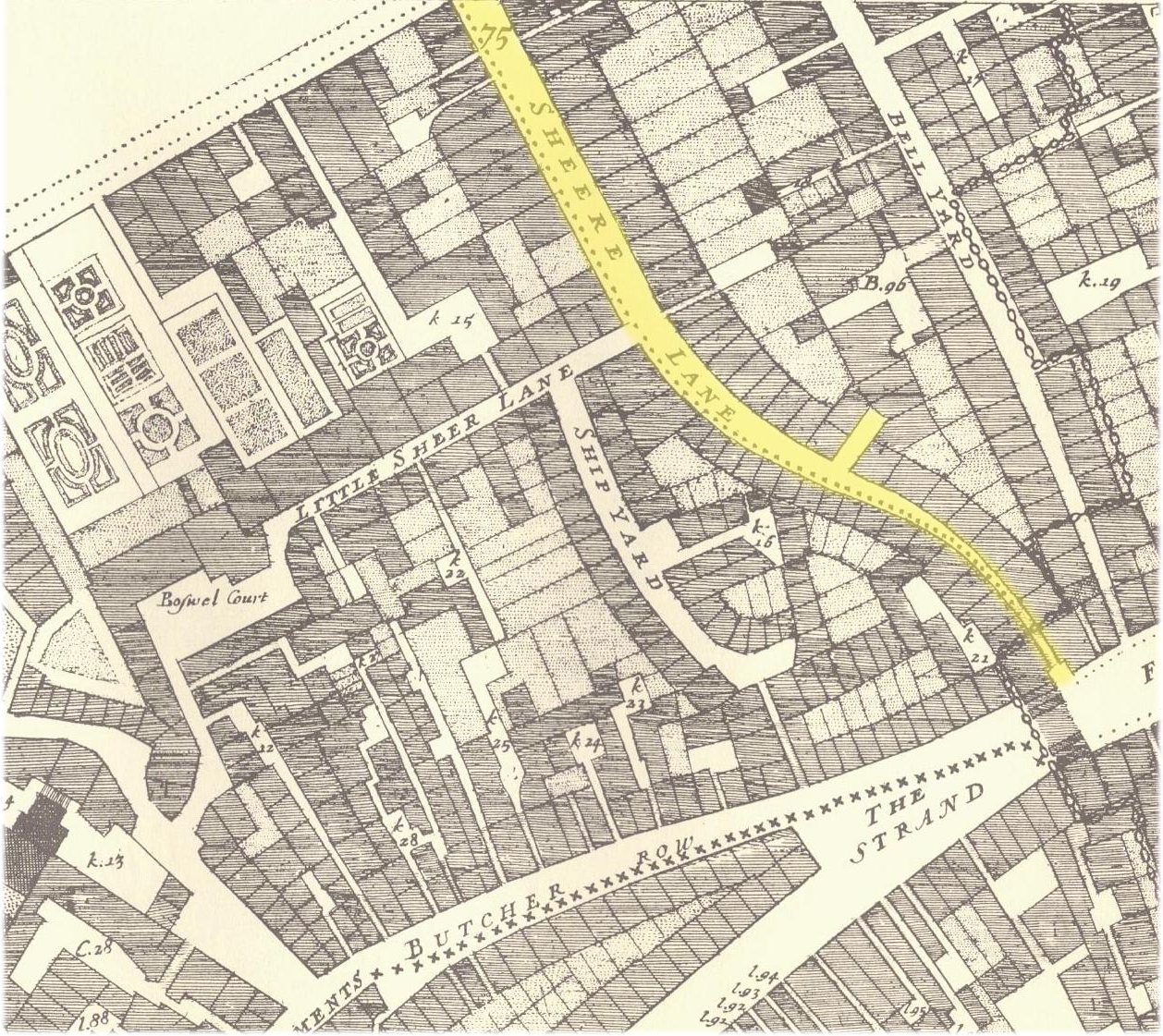
Cousin Lane from John Ogilby & William Morgan’s 1676 Map of the City of London
Daniel Burry (or possibly Berry) was a woodmunger, or domestic fuel (i.e. wood and coal) salesman. He probably traded at the sign of the gate in the terrace row which ran along Cousin Lane and backed onto Dowgate Dock. The properties on the eastern side of Cousin lane backed onto Steel Yard. In the 1662 Hearth Tax returns his property is listed as having 5 hearths.
On 2nd September 1666 this area of the city was destroyed during the first morning of the Great Fire of London. In the first of his famous diary entries (reproduced in part below) which document the progress of the fire Samuel Pepys described its progress that first morning and how he witnessed it engulf the warehouses and storage yards in the vicinity of Steel Yard. These contained a plethora of combustible goods including, brandy and spirits, rope and cord, tallow and wax, wool and cloth, pitch and tar plus coal and (in the case of our particular token issuer) wood.
“(Lord’s day). Some of our mayds sitting up late last night to get things ready against our feast to-day, Jane called us up about three in the morning, to tell us of a great fire they saw in the City. So I rose and slipped on my nightgowne, and went to her window, and thought it to be on the backside of Marke-lane at the farthest; but, being unused to such fires as followed, I thought it far enough off; and so went to bed again and to sleep. About seven rose again to dress myself, and there looked out at the window, and saw the fire not so much as it was and further off. So to my closett to set things to rights after yesterday’s cleaning. By and by Jane comes and tells me that she hears that above 300 houses have been burned down to-night by the fire we saw, and that it is now burning down all Fish-street, by London Bridge. So I made myself ready presently, and walked to the Tower, and there got up upon one of the high places, Sir J. Robinson’s little son going up with me; and there I did see the houses at that end of the bridge all on fire, and an infinite great fire on this and the other side the end of the bridge; which, among other people, did trouble me for poor little Michell and our Sarah on the bridge. So down, with my heart full of trouble, to the Lieutenant of the Tower, who tells me that it begun this morning in the King’s baker’s house in Pudding-lane, and that it hath burned St. Magnus’s Church and most part of Fish-street already. So I down to the water-side, and there got a boat and through bridge, and there saw a lamentable fire. Poor Michell’s house, as far as the Old Swan, already burned that way, and the fire running further, that in a very little time it got as far as the Steeleyard, while I was there. Everybody endeavouring to remove their goods, and flinging into the river or bringing them into lighters that layoff; poor people staying in their houses as long as till the very fire touched them, and then running into boats, or clambering from one pair of stairs by the water-side to another. And among other things, the poor pigeons, I perceive, were loth to leave their houses, but hovered about the windows and balconys till they were, some of them burned, their wings, and fell down. Having staid, and in an hour’s time seen the fire: rage every way, and nobody, to my sight, endeavouring to quench it, but to remove their goods, and leave all to the fire, and having seen it get as far as the Steele-yard, and the wind mighty high and driving it into the City; and every thing, after so long a drought, proving combustible, even the very stones of churches…..”

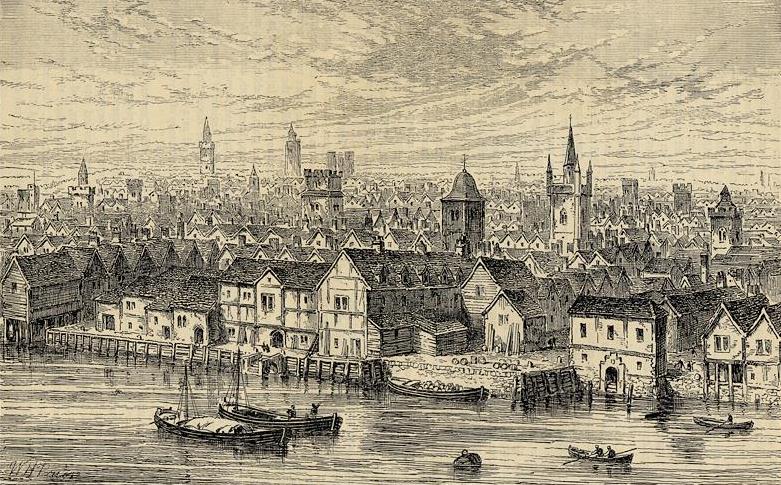
The neighbourhood of Steel Yard on the north bank of the River Thames, London. (c.1540).
After the Great Fire it appears that Daniel Burry re-built his property in Cousin Lane and is recorded as having paid for the staking out of foundations associated with the re-building of at least four other properties in the vicinity of Dowgate. The receipts, each for 6s and 8d, for staking out these various properties were received from Daniel Burry by the city authorities on the following dates;
- Cozen (Cousin) Lane, near Dowgate – 14th December 1667
- Dowgate Hill, at ye west Corner Hill – 7th April 1668
- Dowgate Hill, at ye west Corner Hill – 7th April 1668
- Dowgate Hill, east side – 4th September 1668
- Dowgate Hill, east side – 4th September 1668
The last four of these foundations were surveyed by the famous Robert Hooke under his post Great Fire role of Surveyor of the City of London.
No further information has yet come to light regarding Daniel Burry or his wife (possibly Margaret or Mary) or business post the Great Fire although the present writer has been discovered a burial register entry, dated 23rd February 1698, for a Daniel Burry in the parish registers of All-Hallows-the-Great. This church was situated on Thames Street just east of Steel Yard. It was one of the many parish churches re-built by Sir Christopher Wren after the Great Fire. This church would almost certainly have been that to which Daniel Burry, the woodmunger of Cousin Lane from the 1650s and 60s, would have attended.