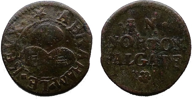
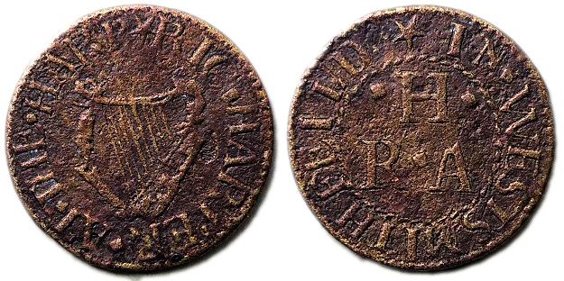
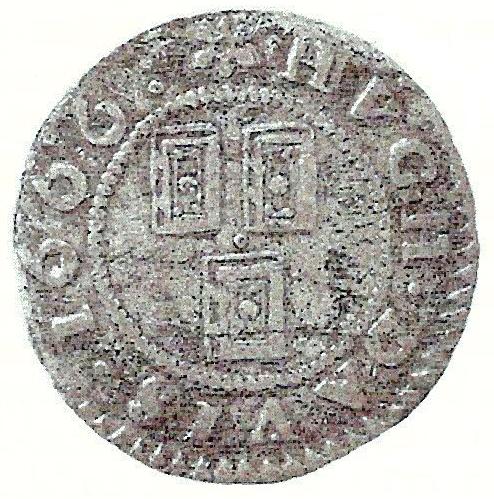
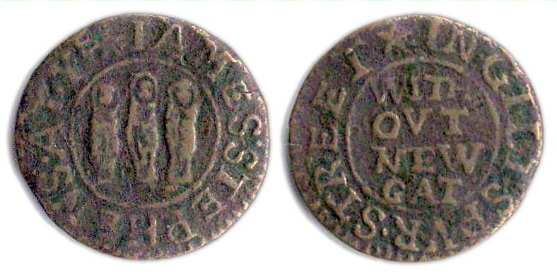
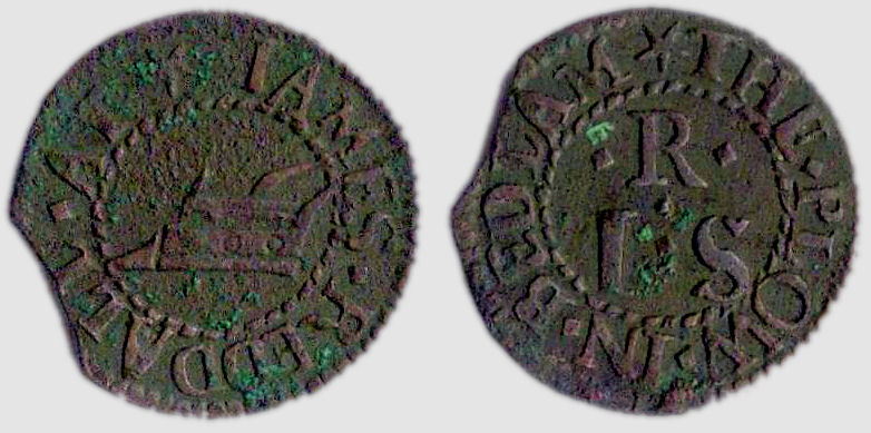
A farthing tradesman’s token issued by Ralph Butcher of Bishopsgate Without, London (Image courtesy of Simmons Gallery)
The above brass farthing token measures 16.9 mm and weighs 0.90 grams. It was issued in the name of Ralph Butcher a tradesman who operated his business in the Bishopsgate Without district of London.
The design of the token may be formally described as follows;
Obverse: A legend in italics in three lines reads; Ralph / Butcher / 1666 .
Reverse: (circle with eight radiating rays) WITHOVT . BISHOPS . GATE , around a twisted wire inner circle within the depiction of a rod from which is suspended six candles, three either side of a lion rampant facing left.
The design on the token’s reverse is almost certainly a depiction of the trade sign which hung over Ralph Butcher’s premises or that of premises adjacent to his. If it was his personal trade sign, and not just an historic one which had long been associated with the building he worked from, its design may well offer clues as to the token issuer’s trade. The rod with suspended candles would have been instantly recognizable in the 17th century as an emblem associated with a wax or tallow chandler (Note 1).
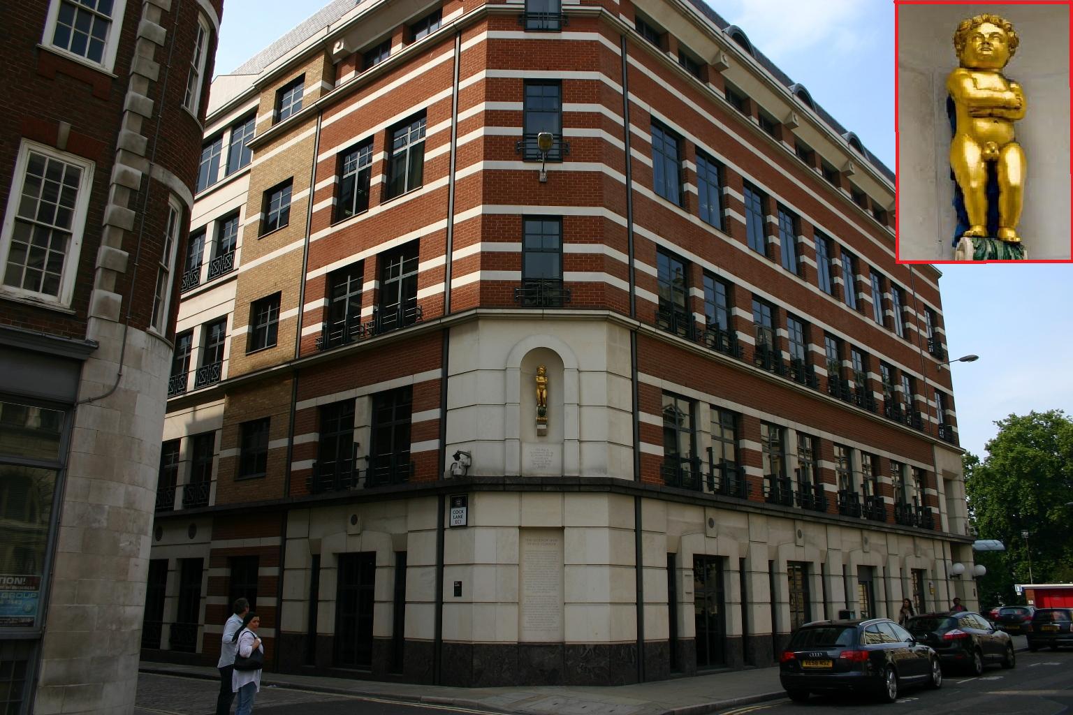
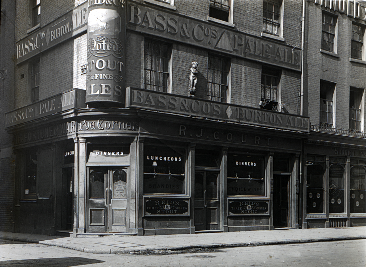
The district in which Ralph Butcher’s trade property was located, i.e. Bishopsgate Without, lay immediately to the north east of London’s city walls outside the Bishopsgate entrance to the city and along the Old North Road. It was one of the parts of London which was spared by the Great Fire of September 1666 which, by coincidence, was the year in which Ralph Butcher issued his token.
In Williamson’s standard catalogue of 17th British tradesmen’s tokens (1) a foot note against the entry for the above token indicates that in 1664 the same Ralph Butcher was trading in Tower Street, within the heart of the City of London. His evidence for this being the existence of a farthing token bearing the sign of the Three Sugar Loaves with the obverse and reverse legends; RALPH BVTCHER. 1664. IN. TOWER. STREETE. The token’s reverse bears a triad of issuer’s initials; R.B.A.
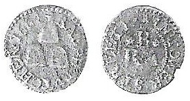
A farthing trade token of Tower Street issued by R & A B in the name of the Three Sugar Loaves in 1664
In addition to indicating the presence of a tradesman by the name of Ralph Butcher operating in Tower Street in 1664 we may deduce from the token that the Christian name of the issuer’s wife began with the letter “A” (e.g. Ann or Agnes for example). In addition, the trade sign indicated (take this word out***), if personal to the issuer and not just a historical one associated with his premises etc., may be indicative of Ralph Butcher being a grocer. The trade sign of one or more sugar loaves was commonly adopted by grocers in 17th century London to mark and advertise their shops (2).

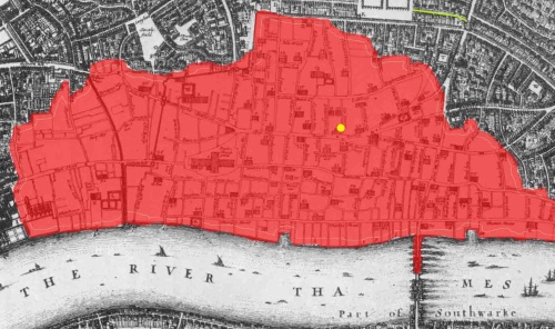
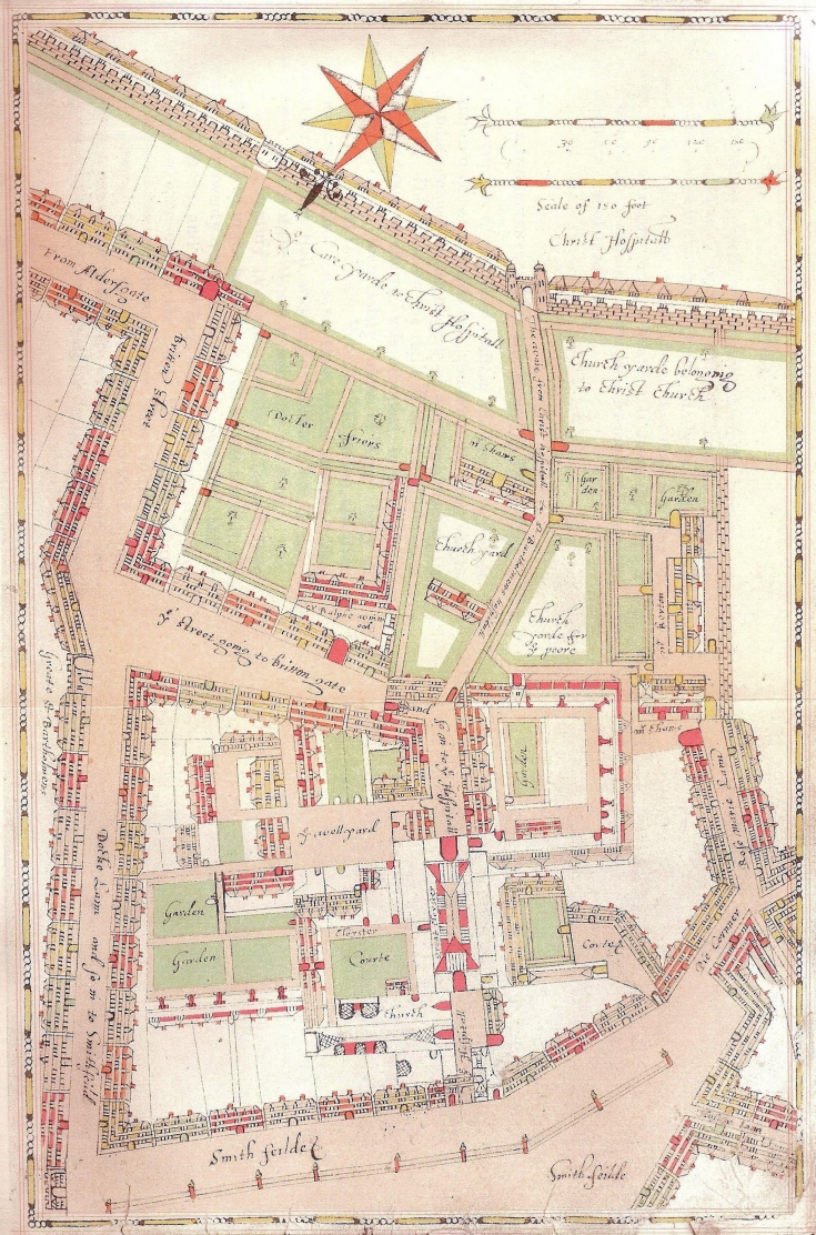
A map of the Ward of Bishopsgate Without, London in c.1720
In Search of the History of Ralph Butcher & His Family
The following brief account of the life of the above token issuer and his immediate family has been pieced together from a variety of sources including parish registers, livery company records, hearth tax and probate records and finally burial registers related to the Society of Friends of London.
Initial searches of transcribed London parish registers and related genealogical data bases (3)(4)(5)(6) has indicated two families with the surname Butcher living in 1660s London having heads of the family by the name Ralph. The first of these families (Ralf and Mary Butcher) lived in the parish of St. Sepulchre, Holborn while the second (Ralph and Ann Butcher) lived, or at least had strong associations, to the parish of St. Botolph, Bishopsgate Without. Given that the Ralph Butcher we are interested in was issuing trade tokens in Bishopsgate Without in 1666 (if not also in Tower Street in 1664) the primary focus obviously falls on the second of the above two identified families.
In an attempt to confirm Ralph Butcher’s profession the trade signs on both the earlier described trade tokens associated with his name have been used as a guide. As previously noted the depiction of a rod of suspended candles or sugar loaves and on trade signs of the period is strongly associated with candle makers and grocers respectively. A review of the master and apprentice records for the Worshipful Companies of Tallow Chandlers, Wax Chandlers and Grocers (7)(8)(9) has failed to identify a Ralph Butcher associated with any of them. As such it is reasonable, but by no means certain, to conclude that our token issuer’s practiced an alternative trade.
The first reference to Ralph and Ann Butcher in the parish of St. Botolph, Bishopsgate Without, occurs in the parish baptisms records where we find the following entry for his son;
5th May 1660 – Simon the son of Ralph and Ann Butcher
Ralph Butcher is further recorded as living in the ‘first precinct on the West” of the parish in the returns from the 1662/3 Hearth Tax. He is listed as paying 10 shillings on a property with 5 hearths (10). Unfortunately the Hearth Tax assessments for Bishopsgate Without from 1666 have not survived. However, those for Tower Street have but contain no listing for a Ralph Butcher.
We can’t be sure if Ralph Butcher, the token issuer of 1666 from Bishopsgate Without, is the same individual who issued the earlier farthing token from a business in Tower Street in 1664. Having now ascertained that both the former and latter tokens were issued by a Ralph Butcher who had a wife whose Christian name began with “A” further supports Williamson’s assumption that both tokens were issued by the same individual.
By 25th January 1668/9 Ralph Butcher’s health was obviously a cause for concern for him as it was on this date that he draw up his Last Will and Testimony (11) This document is very enlightening as its opening sentences not only confirms the status of his health, i.e. being “weak in body but of sound and perfect mind and memory”, but goes on to verify him as being of the parish of St. Botolph, Bishopsgate Without, and his standing as a “citizen and poulterer of London” (Note 2). As a poulterer Ralph would have sold both poultry and game to the general public typically from a street facing open fronted shop located either in front of or below the private rooms of his home.

A 17th Century Poulterer’s Shop – By Frans Snyders (1579–1657)
Ralph Butler’s Will confirms him as still being married to his “loving wife” Ann who he made executrix and principal beneficiary of his estate and worldly goods. His Will makes no mention of any surviving children but does mention the existence of three other “kinsfolk”, namely Richard Butcher, Elizabeth Watkins and a nephew, John Block. To each of these individuals he left only the token sum of one shilling each. Additional sums of 40 shillings each were bequeathed to his good friends William Harwood and Ezekiel Woolley who he also requested to act as overseers of his Will.
Ralph’s Will clearly indicates he owned or had interests in multiple properties. These included his own home and a neighbouring one in the Bethlem district of the parish, the latter of which was then occupied by a William Pemberton. Ralph’s other holdings comprised two copyhold properties in the village of Plaistow in Essex (some 6 miles from Bishopsgate). At that time these were in the hands of tenants, namely George Sherebofe and Ralph’s friend Ezekiel Woolley.
Ralph Butcher went on to live a further 20 months after making his Will. His burial record is enlightening in that it more accurately confirms whereabouts in the parish he was living at the time of his death, the cause of his death (as best known at the time), where he was buried and his precise religious denomination.
Ralph’s death was not recorded in the burial register of St. Botolph, Bishopsgate Without, despite the fact he was still living in the parish at the time. Instead it is to be found in the London and Middlesex burial records of the Society of Friends. It appears that Ralph Butcher was a Quaker. His burial register entry (for 25th November 1670) reads as follows;
Ralph Butcher neer halfe Moon Ally without Bishopsgate Departed this Life the 25th day of the 9th Month 1670 and was buryed in the Burying in Checker Ally his Distemper was given in a Dropsie.
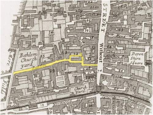
Assuming Ralph didn’t move residences within the parish during the last 20 months of his life we know that the location of his home was between Half Moon Alley and Bethlem (or Bedlam as it was more commonly known). This puts it approximately within the bounds of the red circle in the map below, where Half Moon Alley is marked in yellow.

A map of the Ward of Bishopsgate Without, London (c.1720) indicating the general area where Ralph Butcher is believed to have lived. Half Moon Alley is indicated in yellow.
Ralph’s cause of death is given in his burial record as dropsy. This was the term commonly given in the 17th century to edema, a condition whereby liquid is retained in parts of the body and under the skin causing severe swelling.
Ralph Butler’s body was interred in Chequer Alley Quaker Burial Ground (Note 3) which was located north of the city walls on Bunhill Fields between Upper Moor Fields and Old Street. His Will was proven on 2nd December 1670 (12).
No further conclusive record has been found relating to either Ann or Simon Butcher after Ralph’s death. However, the burial registers of the Society of Friends of London do record the interment, in Chequer Alley Burial Ground, of a still born child on 15th September 1672 to a Richard and Ann Butcher. This poses the question – did Ann Butcher marry Ralph’s “kinsman” Richard after her husband’s death?
Footnotes:
1) An almost identical token in terms of style, design, trade sign and issuing location to that described above for Ralph Butcher was issued in the name of Henry Slater in 1667. It is unclear if Henry operated from neighbouring business premises to Ralph Butcher, thereby qualifying him to use the same trade sign, or if he took over those formerly occupied by Ralph in 1666.
2) George Berry has previously identified only two 17th century poulterers’ token from London. These were issued by John Puller of the Strand and Edmund Warner of Newgate Market (13). The identification of Ralph Butcher’s trade now brings the count of known London poulterers’ token issues to three.
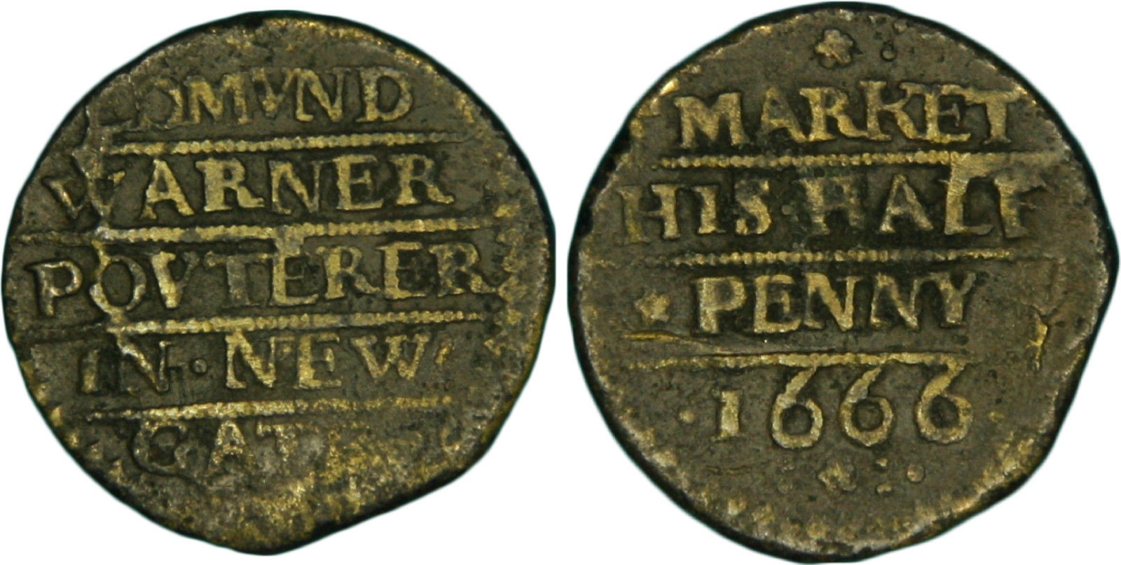
A half penny trade token of 1666 issued by Edmund Warner, a poulterer, of Newgate Market.
3) The site of Chequer or Checker Alley Quaker Burial Ground lies in an area historically known as Bunhill Fields. This name is possibly derived from a corruption of “Bone Hill”, alluding to the area having been used for occasional burials since the early medieval period. There was certainly a mass secondary interment of human remains on the site in 1549 when over 1,000 cartloads of bones were brought from the charnel house of St Paul’s Cathedral after its demolition (14). The initial burial ground site, which comprised 30 square yards, was purchased for the sum of £270 in 1661 by the London Quakers (15). This was the first freehold property owned by Quakers in the city. The plot lay between of Checker Alley, on its southern side and Coleman Street, on its northern edge. This cemetery opened four years earlier than that of the nearby “Dissenters'” burial ground, on the eastern side of Bunhill Row and north of the “New Artillery Ground”. The latter still forms part of Bunhill Fields Cemetery and Memorial Gardens today.

A map of Bunhill Fields in 1676 showing the location (in yellow) of Checker Alley Quaker Burial Ground at its maximum extent in size
As well as burials arising from routine deaths Checker Alley Burial Ground also contains the graves of 1,177 Quakers who died in the Great Plague of 1665/6. The initial plot of 30 square yards quickly became full and additional plots of land were purchased to extend it, until by c.1845 about £3,600 had been invested in the site (16).
Graves were not individually marked with monuments or gravestones. The sole exception was a small tablet on the wall, simply inscribed “G. F.”, in commemoration of George Fox (1624–1691), one of the founders of the Quaker movement. However, so many Quakers came to visit this that it was denounced as being idolatrous by Robert Howard, a prominent member of the Society, and it was destroyed. George Fox is now commemorated by a more modern marker which has also been set against the wall (17).
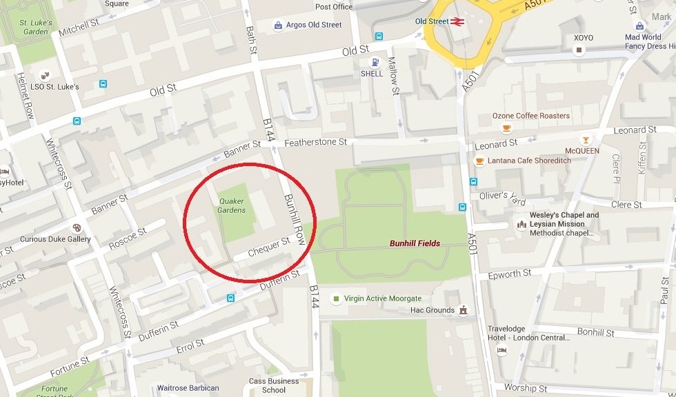
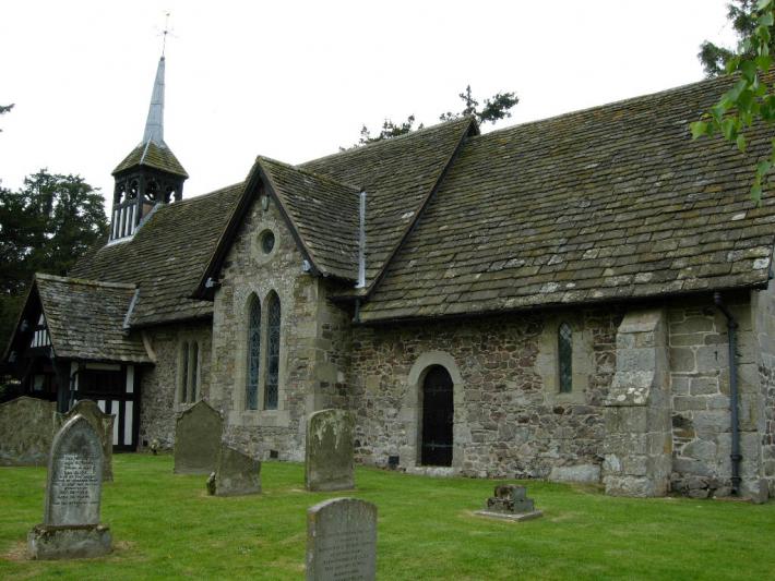
The location of Quaker Gardens south of Old Street, London
The burial ground closed in 1855 by which time it contained approximately 12,000 burials. Shortly after this date work began on the site’s redevelopment. In 1880, as part of the initial land reclamation works some 5,000 bodies were exhumed and re-buried with carbolic acid in a corner of the remaining site (18). The cleared land was subsequently built on until less than half an acre of the original open site remained. What remains of the site today has now been neatly laid out and constitutes Quaker Gardens, a small public garden in the extreme south of the London Borough of Islington. Apart from a couple of memorial plaques, one of which commemorates George Fox, nothing remains to remind the passer-by of its former use or history.
The following video clip presents further information of the Checker Alley Quaker burial ground along with other lost cemeteries of London.
References:
- G.C. – Trade Tokens Issued in the Seventeenth Century in England, Wales and Ireland by Corporations, Merchants, Tradesmen, Etc. – A New and Revised Edition of William Boyne’s Work. – Volume 2. (London, 1967).
- Lillywhite, B. – London Signs: A Reference Book of London Signs from Earliest Times to about the Mid Nineteenth Century. (London, 1972).
- Searched via the data bases available at Ancestry – Genealogy, Family Trees & Family History Records (http://www.ancestry.co.uk/).
- Searched via the data bases available at Findmypast – Genealogy, Family Trees & Family History Records (www.findmypast.co.uk).
- Searched via the data bases available at FamilySearch – Genealogy, Family Trees & Family History Records (https://familysearch.org/).
- Boyd, P. – Inhabitants of London. A genealogical Index held by the Society of Genealogists, London.
- Webb, C – London Livery Company Apprenticeship Records – Tallow Chandlers’ Company. 1633-1800. Society of Genealogists (London, 2003).
- Webb, C – London Livery Company Apprenticeship Records – Wax Chandlers’ Company. 1666-1800. Society of Genealogists (London, 2000).
- Webb, C – London Livery Company Apprenticeship Records – Grocers’ Company. 1629-1800. Society of Genealogists (London, 2008).
- Davies, M.; Ferguson, C.; Harding, V.; Parkinson, E. & Wareham, A. – London and Middlesex Hearth Tax. The British Record Society. Hearth Tax Series Volume IX, Part II. (London, 2014).
- Reference Number: MS 9172/61. Will Number: 154. London Metropolitan Archives and Guildhall Library Manuscripts Section, Clerkenwell, London
- Ibid 11.
- Berry, G. – Seventeenth Century England: Traders and their Tokens. (London, 1988).
- Holmes, B. – The London Burial Grounds: Notes on their history from earliest times to the present day. (New York. 1894).
- Butler, D.M. – The Quaker Meeting Houses of Britain Volume 1. (Friends Historical Society. London. 1999).
- Ibid 15.
- Bowes-Isaacson, L. & P. – Notes for Visitors to Bunhill. (Bunhill Fields Meeting House. 2001).
- The British Architect and Norther Engineer. Volume 7. January to June 1877. Bunhill Fields. Page 321. (Manchester. 1877).